NZ Topo - object class cliff_edge
This page describe the cliff_edge object class used to represent objects in the NZTopo topographic database.
Description
A high, steep or overhanging face or rock. Can be rock.
Topo50 description
Only those significant either by their size or location, or where contours do not adequately depict the terrain, are held in the data and shown on the printed maps. Note that those in heavily build-up areas are not usually held in the data or shown on the printed maps. A named cliff may be held in the data as a geographic_name feature, and shown on the printed maps by it's name only. Eg. 'Benvenue Cliffs'
Topo250 description
Only those significant by their size or location are held in the Topo250 data and shown on the Topo250 printed maps; these are a generalised subset of those shown on the Topo50 series
Class attributes
| Attribute | Value |
|---|---|
| Object class | cliff_edge |
| Entity class | CLIFF |
| Additional entity class | Not applicable |
| Object inheritance | simple_line |
| Entity source | US Standard Entity |
| Map series | Topo50 Topo250 Ant50 |
| LSLIFF object class | 23 |
Object attributes
This object class does not have attributes.
Change log
| Feature version | Revised | Description |
|---|---|---|
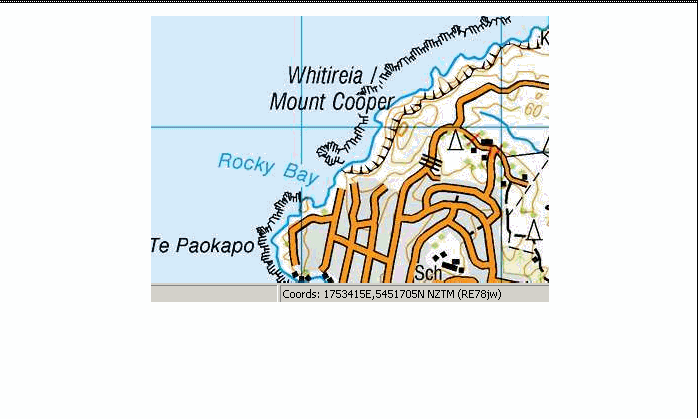
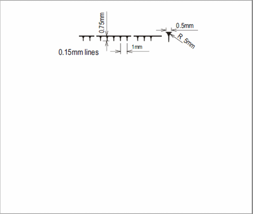
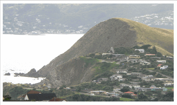
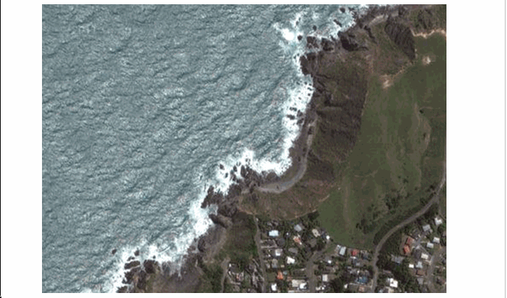
| 4 | 2012-08-28 | Updated map image and aerial view; added representation specification and example feature photographs |
| 3 | 2012-08-28 | Added scale-specific definitions |
| 2 | 2001-11-23 | Unspecified update |
| 1 | 1999-03-01 | intial status |