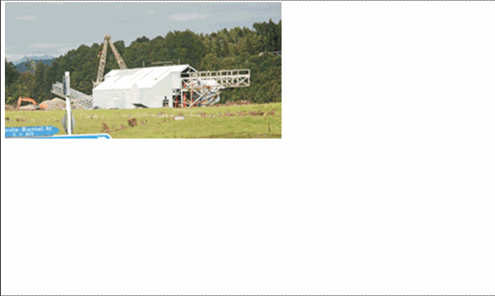
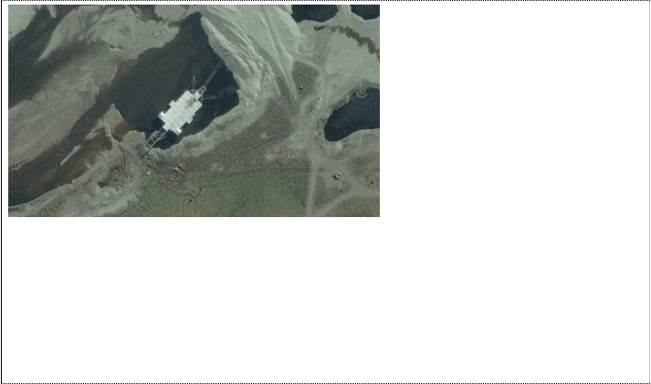
NZ Topo - object class dredge_pnt
This page describe the dredge_pnt object class used to represent objects in the NZTopo topographic database.
Description
Apparatus for clearing out mud etc from river or sea bottom.
Topo50 description
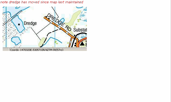
Dredges can be difficult to identify and can move frequently.Those held in the data and shown on the printed maps may only be a sample of those operating
See also: dredge_tailing_cl
Class attributes
| Attribute | Value |
|---|---|
| Object class | dredge_pnt |
| Entity class | DREDGE |
| Additional entity class | Not applicable |
| Object inheritance | graphic_point |
| Entity source | Proposed NZ Std Entity |
| Map series | Topo50 |
| LSLIFF object class | 32 |
Object attributes
| Attribute | LSLIFF code Shapefile field Data type |
Attribute description | Attribute values* | |||||
|---|---|---|---|---|---|---|---|---|
| dredge_status | 1026 status string |
Values
|
|
|||||
| UFID | 1000 t50_fid integer |
A unique identifier for use on Topo50 data in the LINZ Data Service. This is not a universal ID. The intention is to manage these ID’s as persistent, however this is not guaranteed and there will be instances where what appears to be a minor change to a feature may result in a new ID being assigned. |
|
* See explanation of attribute values for more information about how attribute values are represented.
Change log
| Feature version | Revised | Description |
|---|---|---|
| 5 | 2012-08-28 | Updated map image and aerial view; added representation specification and example feature photographs |
| 4 | 2012-08-28 | Added scale-specific definitions |
| 3 | 2012-08-27 | Updated description |
| 2 | 2001-11-23 | Unspecified update |
| 1 | 1999-03-01 | intial status |