NZ Topo - object class dry_dock_poly
This page describe the dry_dock_poly object class used to represent objects in the NZTopo topographic database.
Description
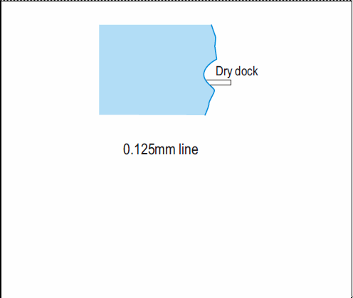
An artificial basin fitted with gate or caisson into which a vessel may be floated and from which the water may be pumped out to expose the bottom of the vessel
Topo50 description
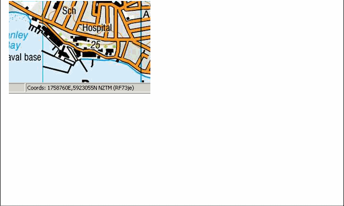
At the time of writing, there was only one known dry dock in the country - see map example.
Class attributes
| Attribute | Value |
|---|---|
| Object class | dry_dock_poly |
| Entity class | DRY DOCK |
| Additional entity class | Not applicable |
| Object inheritance | simple_area |
| Entity source | US Standard Entity |
| Map series | Topo50 |
| LSLIFF object class | 307 |
Object attributes
| Attribute | LSLIFF code Shapefile field Data type | Attribute description | Attribute values* | ||
|---|---|---|---|---|---|
| dry_dock_type | 1027 type string |
| |||
| UFID | 1000 t50_fid integer | A unique identifier for use on Topo50 data in the LINZ Data Service. This is not a universal ID. The intention is to manage these ID’s as persistent, however this is not guaranteed and there will be instances where what appears to be a minor change to a feature may result in a new ID being assigned. |
|
* See explanation of attribute values for more information about how attribute values are represented.
Change log
| Feature version | Revised | Description |
|---|---|---|
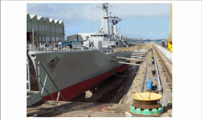
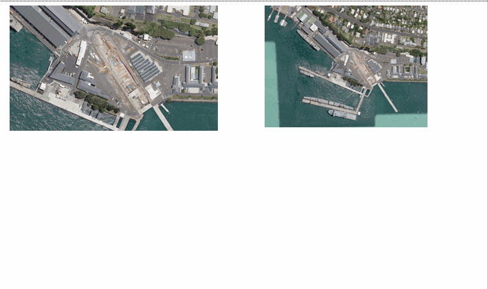
| 5 | 2012-08-28 | Updated map image and aerial view; added representation specification and example feature photographs |
| 4 | 2012-08-28 | Added scale-specific definitions |
| 3 | 2008-04-10 | Removed reference to seed and void objects |
| 2 | 2001-11-23 | Unspecified update |
| 1 | 1999-03-01 | intial status |