NZ Topo - object class pipeline_cl
This page describe the pipeline_cl object class used to represent objects in the NZTopo topographic database.
Description
A closed pressure system,usually constructed of steel or ferro concrete pipes.
Topo50 description
Only an incomplete selection of pipelines has been able to be collected. As a result underground gas pipelines have become a legacy feature. This means that they will remain in the data until a sheet undergoes revision. During this process, any underground gas pipelines will be deleted for that sheet.
Topo250 description
Only those significant by their size or location are held in the Topo250 data and shown on the Topo250 printed maps; these are a generalised subset of those shown on the Topo50 series
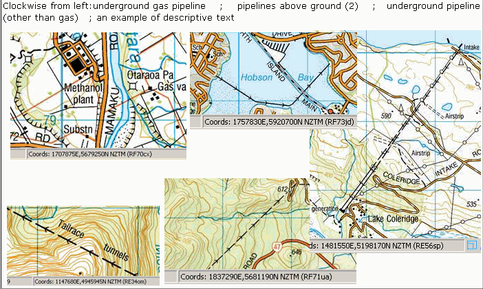


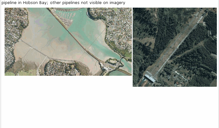
Important information: Not all pipelines (either underground or above ground) are held in the data or shown on the printed maps. For the latest information please contact the utility and infrastructure agencies
See also: gas_valve_pnt
Class attributes
| Attribute | Value |
|---|---|
| Object class | pipeline_cl |
| Entity class | TRANSMISSION LINE |
| Additional entity class | Not applicable |
| Object inheritance | simple_line |
| Entity source | US Standard Entity |
| Map series | Topo50 Topo250 |
| LSLIFF object class | 93 |
Object attributes
| Attribute | LSLIFF code Shapefile field Data type |
Attribute description | Attribute values* | |||||||
|---|---|---|---|---|---|---|---|---|---|---|
| pipeline_use | 1062 pipe_use string |
|
||||||||
| pipeline_visibility | 1063 visibility string |
|
||||||||
| UFID | 1000 t50_fid integer |
A unique identifier for use on Topo50 data in the LINZ Data Service. This is not a universal ID. The intention is to manage these ID’s as persistent, however this is not guaranteed and there will be instances where what appears to be a minor change to a feature may result in a new ID being assigned. |
|
* See explanation of attribute values for more information about how attribute values are represented.
Change log
| Feature version | Revised | Description |
|---|---|---|
| 5 | 2012-08-28 | Updated map image and aerial view; added representation specification and example feature photographs |
| 4 | 2012-08-28 | Added scale-specific definitions |
| 3 | 2002-06-18 | new attribute value |
| 2 | 2001-11-23 | Unspecified update |
| 1 | 1999-03-01 | intial status |