NZ Topo - object class railway_cl
This page describe the railway_cl object class used to represent objects in the NZTopo topographic database.
Description
A permanent way having one or more rails which provides a track for trains or trams
Topo50 description
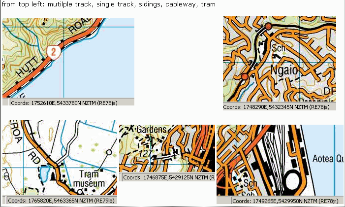
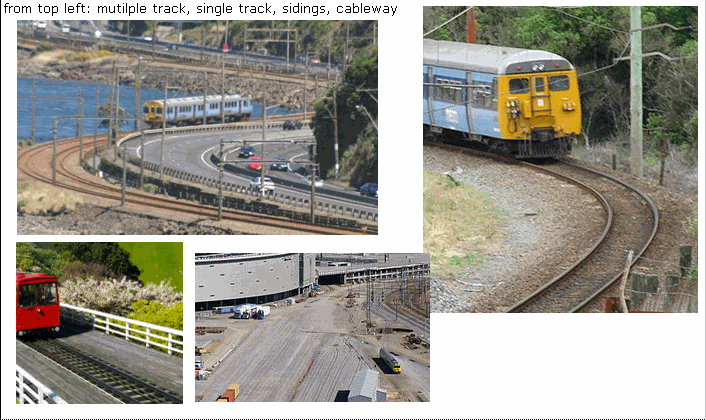
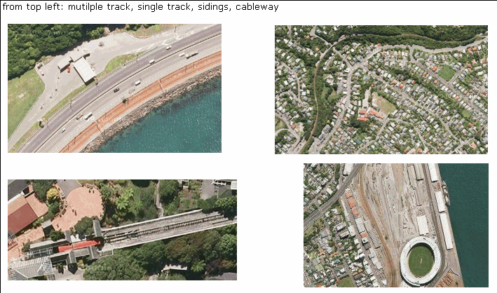
All mainline railway lines are held in the Topo50 data and shown on the Topo50 printed maps. Where a railway line is located close to a road, the line held in the data and shown on the printed map may be offset from the road sufficient that the two symbols are recognisable at 1:50,000. Multiple sidings may be held in the data and shown on the printed maps as a single feature
Topo250 description
Most railway lines are held in the Topo250 data and shown on the Topo250 printed maps; they are generalised from those shown on the Topo50 series
See also: rail_station_pnt bridge_cl tunnel_cl
Class attributes
| Attribute | Value |
|---|---|
| Object class | railway_cl |
| Entity class | RAILWAY |
| Additional entity class | Not applicable |
| Object inheritance | simple_line |
| Entity source | Proposed change to US Entity |
| Map series | Topo50 Topo250 Topo500 |
| LSLIFF object class | 107 |
Object attributes
| Attribute | LSLIFF code Shapefile field Data type |
Attribute description | Attribute values* | ||||||
|---|---|---|---|---|---|---|---|---|---|
| name | 1001 name string |
The name of the railway line, where known. Text data from July 2012 will be in UTF-8 format. If your system is not UTF-8 compliant, you will need to use the name_ascii attribute, which has had any macronated vowels removed. UTF-8 stands for Unicode Transformation Format-8. It is an octet (8-bit) lossless encoding of Unicode characters. UTF-8 encodes each Unicode character as a variable number of 1 to 4 octets, where the number of octets depends on the integer value assigned to the Unicode character. It is an efficient encoding of Unicode documents that use mostly US-ASCII characters because it represents each character in the range U+0000 through U+007F as a single octet. UTF-8 is the default encoding for XML. |
|
||||||
| name_macronated | 1140 macronated boolean |
Indicates whether the entry in the name_ascii field contains a macronated vowel. Where the value is "Y" go to http://www.linz.govt.nz/regulatory/place-names/find-place-name/find-m%C4%81ori-place-names-dual-names-and-alternative-names for a list of places or feature names within New Zealand that are gazetted and include macrons |
|
||||||
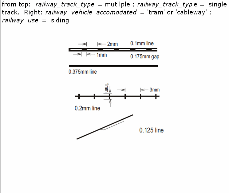
| railway_track_type | 1072 track_type string |
|
|||||||
| railway_vehicle_accomodated | 1073 veh_type string |
Values
|
|
||||||
| railway_use | 1074 rway_use string |
|
|||||||
| railway_status | 1075 status string |
|
|||||||
| name_ascii | 9000 name_ascii string |
Text data from July 2012 will be in UTF-8 format. If your system is not UTF-8 compliant, you will need to use this attribute, which has had any macronated vowels removed. | |||||||
| UFID | 1000 t50_fid integer |
A unique identifier for use on Topo50 data in the LINZ Data Service. This is not a universal ID. The intention is to manage these ID’s as persistent, however this is not guaranteed and there will be instances where what appears to be a minor change to a feature may result in a new ID being assigned. |
|
* See explanation of attribute values for more information about how attribute values are represented.
Change log
| Feature version | Revised | Description |
|---|---|---|
| 9 | 2014-06-12 | Added "rail cart" value for railway_vehicle_accomodated |
| 8 | 2012-08-28 | Updated map image and aerial view; added representation specification and example feature photographs |
| 7 | 2012-08-28 | Added scale-specific definitions |
| 6 | 2012-08-16 | Name attribute in UTF-8 format; added name_ascii attribute |
| 5 | 2010-03-01 | Added name_macronated attribute |
| 4 | 2003-06-30 | removed attribute |
| 3 | 2001-11-23 | Unspecified update |
| 2 | 2000-03-31 | new attribute |
| 1 | 1999-03-01 | initial status |