NZ Topo - object class reef_poly
This page describe the reef_poly object class used to represent objects in the NZTopo topographic database.
Description
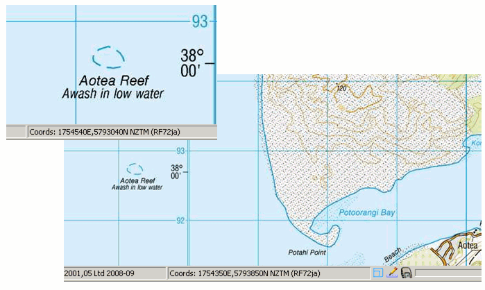
A ridge, usually of rocks or coral, lying near the surface of the sea, which may be visible at low tide, but is usually covered with water
Topo50 description
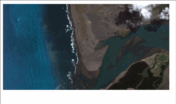
Only those significant either by their size or location, and sufficiently visible (water quality and wind conditions at the time imagery is collected can influence the ability to capture these features with certainty and accuracy), are held in the data and shown on the printed maps. LINZ charts may be a better source for reef features, see http://www.linz.govt.nz/hydro/charts/index.aspx
Class attributes
| Attribute | Value |
|---|---|
| Object class | reef_poly |
| Entity class | REEF |
| Additional entity class | Not applicable |
| Object inheritance | simple_area |
| Entity source | Proposed change to US Entity |
| Map series | Topo50 |
| LSLIFF object class | 331 |
Object attributes
| Attribute | LSLIFF code Shapefile field Data type |
Attribute description | Attribute values* | ||
|---|---|---|---|---|---|
| name | 1001 name string |
The name of the reef, where known. Text data from July 2012 will be in UTF-8 format. If your system is not UTF-8 compliant, you will need to use the name_ascii attribute, which has had any macronated vowels removed. UTF-8 stands for Unicode Transformation Format-8. It is an octet (8-bit) lossless encoding of Unicode characters. UTF-8 encodes each Unicode character as a variable number of 1 to 4 octets, where the number of octets depends on the integer value assigned to the Unicode character. It is an efficient encoding of Unicode documents that use mostly US-ASCII characters because it represents each character in the range U+0000 through U+007F as a single octet. UTF-8 is the default encoding for XML. |
|
||
| name_macronated | 1140 macronated boolean |
Indicates whether the entry in the name_ascii field contains a macronated vowel. Where the value is "Y" go to http://www.linz.govt.nz/regulatory/place-names/find-place-name/find-m%C4%81ori-place-names-dual-names-and-alternative-names for a list of places or feature names within New Zealand that are gazetted and include macrons |
|
||
| reef_composition | 1077 compositn string |
|
|||
| name_ascii | 9000 name_ascii string |
Text data from July 2012 will be in UTF-8 format. If your system is not UTF-8 compliant, you will need to use this attribute, which has had any macronated vowels removed. | |||
| UFID | 1000 t50_fid integer |
A unique identifier for use on Topo50 data in the LINZ Data Service. This is not a universal ID. The intention is to manage these ID’s as persistent, however this is not guaranteed and there will be instances where what appears to be a minor change to a feature may result in a new ID being assigned. |
|
* See explanation of attribute values for more information about how attribute values are represented.
Change log
| Feature version | Revised | Description |
|---|---|---|
| 7 | 2012-08-28 | Updated map image and aerial view; added representation specification and example feature photographs |
| 6 | 2012-08-28 | Added scale-specific definitions |
| 5 | 2012-08-16 | Name attribute in UTF-8 format; added name_ascii attribute |
| 4 | 2010-03-01 | Added name_macronated attribute |
| 3 | 2008-04-10 | Removed reference to seed and void objects |
| 2 | 2001-11-23 | Unspecified update |
| 1 | 1999-03-01 | intial status |