NZ Topo - object class reservoir_poly
This page describe the reservoir_poly object class used to represent objects in the NZTopo topographic database.
Description
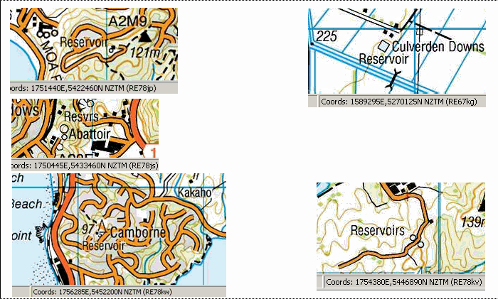
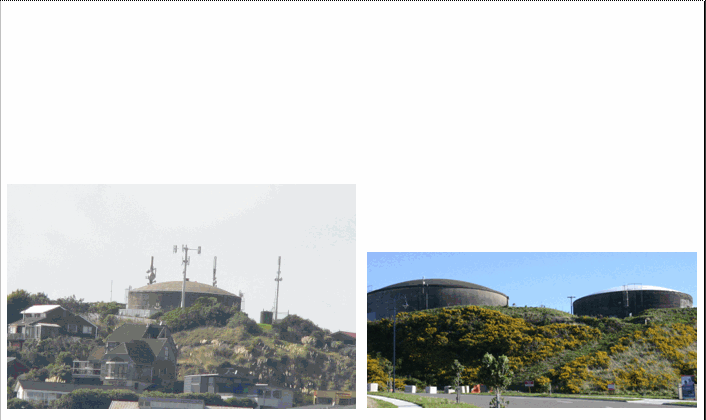
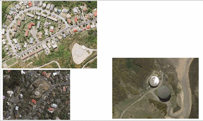
Reservoir; receptacle in which a large quantity of water is stored
Topo50 description
Only those significant either by their size or location are held in the data and shown on the printed maps. Some reservoirs have been captured as 'lakes' with an attribute of lake_use = reservoir
Class attributes
| Attribute | Value |
|---|---|
| Object class | reservoir_poly |
| Entity class | TANK |
| Additional entity class | LAKE |
| Object inheritance | simple_area |
| Entity source | US Standard Entity |
| Map series | Topo50 |
| LSLIFF object class | 333 |
Object attributes
| Attribute | LSLIFF code Shapefile field Data type |
Attribute description | Attribute values* | ||
|---|---|---|---|---|---|
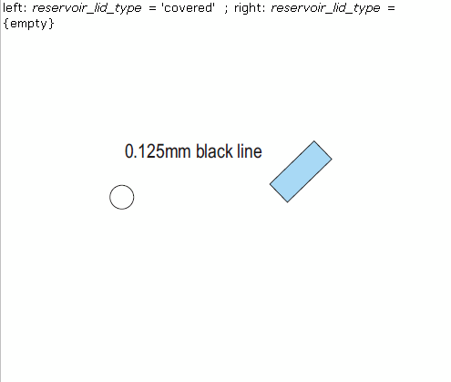
| reservoir_lid_type | 1078 lid_type string |
|
|||
| UFID | 1000 t50_fid integer |
A unique identifier for use on Topo50 data in the LINZ Data Service. This is not a universal ID. The intention is to manage these ID’s as persistent, however this is not guaranteed and there will be instances where what appears to be a minor change to a feature may result in a new ID being assigned. |
|
* See explanation of attribute values for more information about how attribute values are represented.
Change log
| Feature version | Revised | Description |
|---|---|---|
| 6 | 2012-08-28 | Updated map image and aerial view; added representation specification and example feature photographs |
| 5 | 2012-08-28 | Added scale-specific definitions |
| 4 | 2010-03-01 | object class change |
| 3 | 2008-04-10 | Removed reference to seed and void objects |
| 2 | 2001-11-23 | Unspecified update |
| 1 | 1999-03-01 | intial status |