NZ Topo - object class rock_outcrop_pnt
This page describe the rock_outcrop_pnt object class used to represent objects in the NZTopo topographic database.
Description
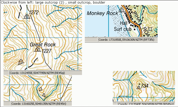
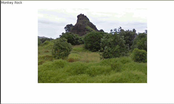
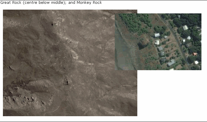
An isolated rock formation that constitutes a prominent or unusual landmark
Topo50 description
Only those outcrops significant either by their size or location are held in the data and shown on the printed maps.
Topo250 description
Only those significant by their size or location are held in the Topo250 data and shown on the Topo250 printed maps; these are a generalised subset of those shown on the Topo50 series
Class attributes
| Attribute | Value |
|---|---|
| Object class | rock_outcrop_pnt |
| Entity class | PINNACLE |
| Additional entity class | Not applicable |
| Object inheritance | simple_point |
| Entity source | US Standard Entity |
| Map series | Topo50 Topo250 Ant50 |
| LSLIFF object class | 127 |
Object attributes
| Attribute | LSLIFF code Shapefile field Data type | Attribute description | Attribute values* | |||||||||
|---|---|---|---|---|---|---|---|---|---|---|---|---|
| name | 1001 name string | The name of the rock outcrop, where known. Text data from July 2012 will be in UTF-8 format. If your system is not UTF-8 compliant, you will need to use the name_ascii attribute, which has had any macronated vowels removed. UTF-8 stands for Unicode Transformation Format-8. It is an octet (8-bit) lossless encoding of Unicode characters. UTF-8 encodes each Unicode character as a variable number of 1 to 4 octets, where the number of octets depends on the integer value assigned to the Unicode character. It is an efficient encoding of Unicode documents that use mostly US-ASCII characters because it represents each character in the range U+0000 through U+007F as a single octet. UTF-8 is the default encoding for XML. |
| |||||||||
| name_macronated | 1140 macronated boolean | Indicates whether the entry in the name_ascii field contains a macronated vowel. Where the value is "Y" go to http://www.linz.govt.nz/regulatory/place-names/find-place-name/find-m%C4%81ori-place-names-dual-names-and-alternative-names for a list of places or feature names within New Zealand that are gazetted and include macrons |
| |||||||||
| elevation | 1021 elevation real | The height above mean sea level at the top of the rock outcrop |
| |||||||||
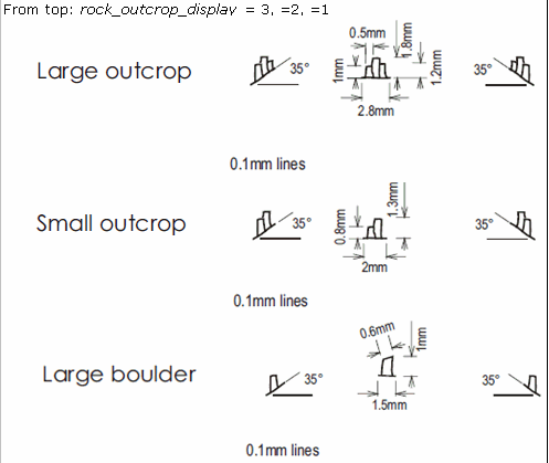
| rock_outcrop_display | 1129 display integer | Values
|
| |||||||||
| name_ascii | 9000 name_ascii string | Text data from July 2012 will be in UTF-8 format. If your system is not UTF-8 compliant, you will need to use this attribute, which has had any macronated vowels removed. | ||||||||||
| UFID | 1000 t50_fid integer | A unique identifier for use on Topo50 data in the LINZ Data Service. This is not a universal ID. The intention is to manage these ID’s as persistent, however this is not guaranteed and there will be instances where what appears to be a minor change to a feature may result in a new ID being assigned. |
| |||||||||
| orientation | 1115 orientatn string | The orientation or angle of the feature as it is shown on the map. This is measured in radians starting from due east, in a counter- clockwise direction for positive numbers or clockwise for negative numbers. |
|
* See explanation of attribute values for more information about how attribute values are represented.
Change log
| Feature version | Revised | Description |
|---|---|---|
| 8 | 2020-04-08 | added orientation attribute |
| 7 | 2012-08-28 | Updated map image and aerial view; added representation specification and example feature photographs |
| 6 | 2012-08-28 | Added scale-specific definitions |
| 5 | 2012-08-16 | Name attribute in UTF-8 format; added name_ascii attribute |
| 4 | 2010-03-01 | object class change, added name_macronated attribute and removed orientation attribute |
| 3 | 2001-11-23 | Unspecified update |
| 2 | 1999-10-01 | new attribute |
| 1 | 1999-03-01 | initial status |