NZ Topo - object class showground_poly
This page describe the showground_poly object class used to represent objects in the NZTopo topographic database.
Description
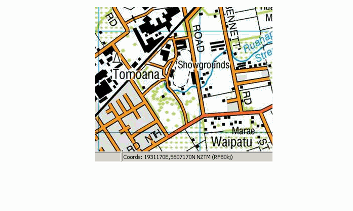
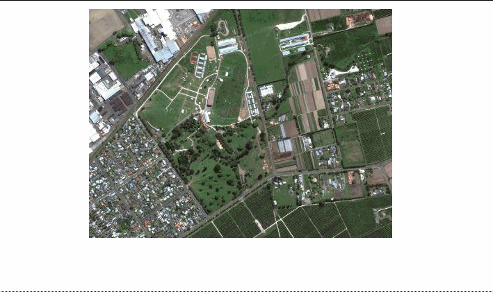
A public area containing buildings, paddocks etc. for the display of livestock, agricultural produce, machinery, and the like.
Topo50 description
Only those significant either by their size or location are held in the data and shown on the printed maps.
Class attributes
| Attribute | Value |
|---|---|
| Object class | showground_poly |
| Entity class | SHOW GROUND |
| Additional entity class | Not applicable |
| Object inheritance | simple_area |
| Entity source | US Standard Entity |
| Map series | Topo50 |
| LSLIFF object class | 344 |
Object attributes
This object class does not have attributes.
Change log
| Feature version | Revised | Description |
|---|---|---|
| 6 | 2012-08-28 | Updated map image and aerial view; added representation specification and example feature photographs |
| 5 | 2012-08-28 | Added scale-specific definitions |
| 4 | 2010-03-01 | object class change |
| 3 | 2008-04-10 | Removed reference to seed and void objects |
| 2 | 2001-11-23 | Unspecified update |
| 1 | 1999-03-01 | intial status |