NZ Topo - object class snow_poly
This page describe the snow_poly object class used to represent objects in the NZTopo topographic database.
Description
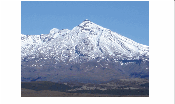
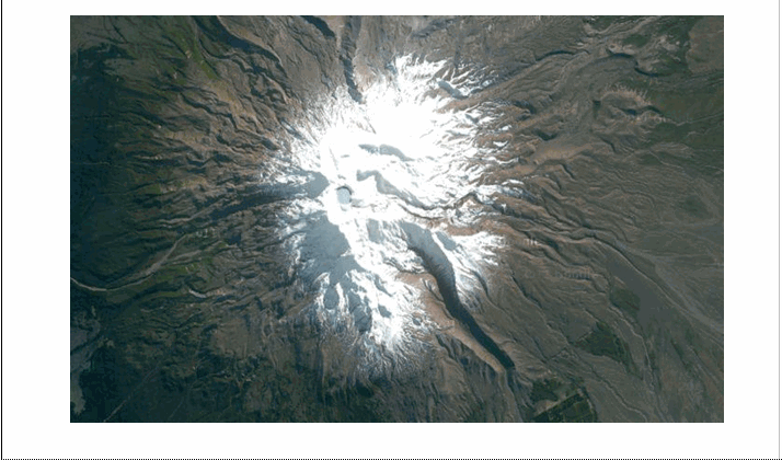
A region of permanent snow.
Topo50 description
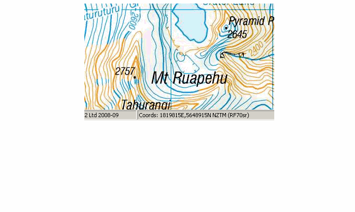
Permanent snow and ice is defined as that which remains after the summer thaw. Areas of ice and snow were defined by the Department of Science and Industrial Research (DSIR) during the mid 1980’s over the entire country. Some areas have been updated from studies undertaken at the University of Otago . To keep the database in line with international entity specifications areas of snow and ice will be captured using both snow_poly and ice_poly objects
Topo250 description
Only those areas significant by their size are held in the Topo250 data and shown on the Topo250 printed maps; these are a generalised subset of those shown on the Topo50 series
See also: ice_poly
Class attributes
| Attribute | Value |
|---|---|
| Object class | snow_poly |
| Entity class | SNOWFIELD |
| Additional entity class | Not applicable |
| Object inheritance | simple_area |
| Entity source | US Standard Entity |
| Map series | Topo250 Ant50 Topo50 Topo500 |
| LSLIFF object class | 346 |
Object attributes
This object class does not have attributes.
Change log
| Feature version | Revised | Description |
|---|---|---|
| 6 | 2012-08-28 | Updated map image and aerial view; added representation specification and example feature photographs |
| 5 | 2012-08-28 | Added scale-specific definitions |
| 4 | 2010-03-01 | Added name_macronated attribute |
| 3 | 2008-04-10 | Removed reference to seed and void objects |
| 2 | 2001-08-21 | comments |
| 1 | 1999-03-01 | intial status |