NZ Topo - object class stockyard_pnt
This page describe the stockyard_pnt object class used to represent objects in the NZTopo topographic database.
Description
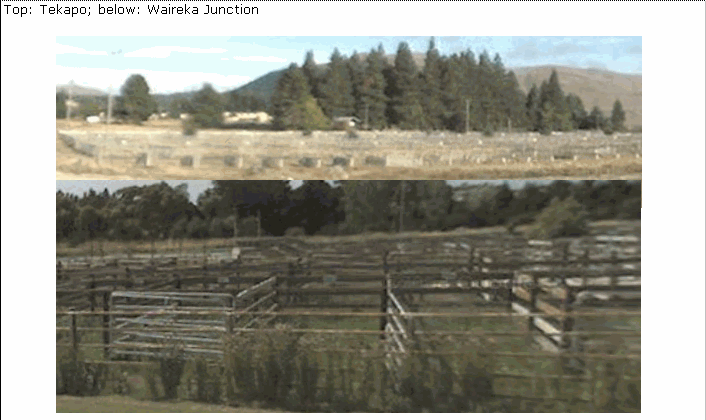
A holding place for livestock (cattle, sheep etc.)
Topo50 description
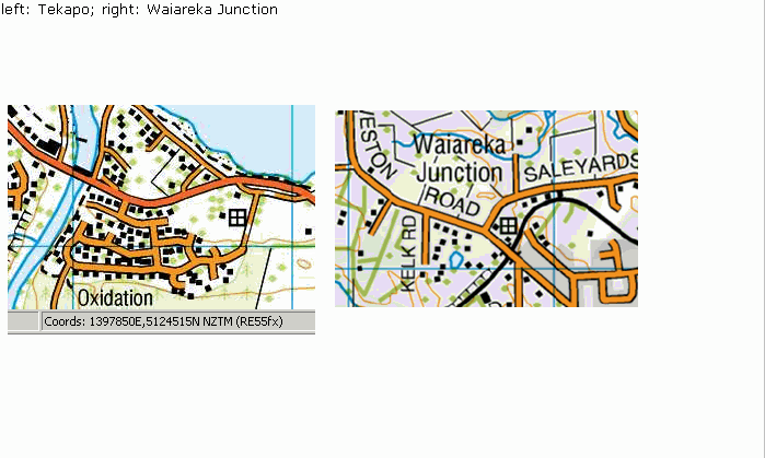
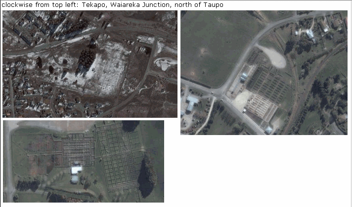
Not all stockyards are held in the data and shown on the printed maps. Only those significant either by their size or location are captured. Where a stockyard is located close to a road, the point held in the data and shown on the printed maps may be offset from the road a distance of up to 30m
Class attributes
| Attribute | Value |
|---|---|
| Object class | stockyard_pnt |
| Entity class | STOCKYARD |
| Additional entity class | Not applicable |
| Object inheritance | graphic_point |
| Entity source | US Standard Entity |
| Map series | Topo50 |
| LSLIFF object class | 202 |
Object attributes
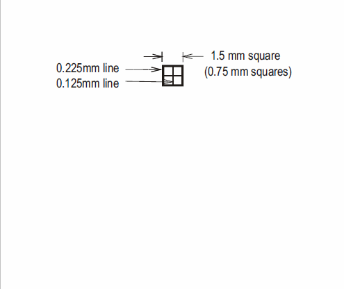
This object class does not have attributes.
Change log
| Feature version | Revised | Description |
|---|---|---|
| 5 | 2012-08-28 | Updated map image and aerial view; added representation specification and example feature photographs |
| 4 | 2012-08-28 | Added scale-specific definitions |
| 3 | 2010-03-01 | removed orientation attribute |
| 2 | 2004-05-28 | new orientation attribute |
| 1 | 2003-06-30 | new object class |