NZ Topo - object class coastline
This page describe the coastline object class used to represent objects in the NZTopo topographic database.
Description
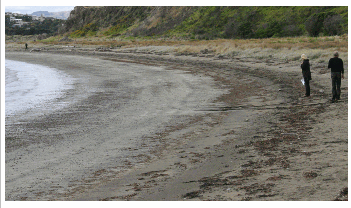
The line forming the boundary between the land and sea, defined by mean high water.
Topo50 description
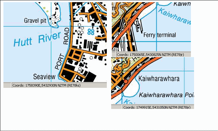
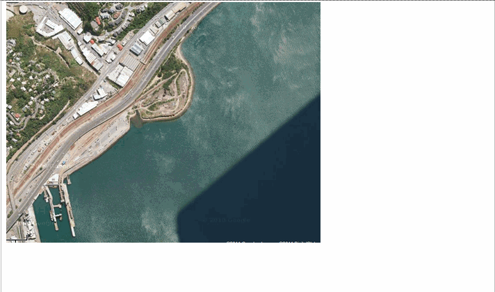
The value of MHW varies across the country from 0.5 to 2.5m above MSL. To find out more information about Tidal Levels refer to the Tidal Information in the NZ Nautical Almanac http://www.linz.govt.nz/hydro/nautical-info/about-nz-almanac. Note also that the coastline feature is reserved in the data for the North, South and Stewart Islands of mainland New Zealand. All the remaining islands have their 'coastline' captured as island_poly. Where coastline is close to a road, the printed map may only show the road representation; both features are held in the data. Where the coastline is a wharf edge, the printed map may only show the wharf representation; again both features are held in the data.
Topo250 description
A generalised subset of the Topo50 coastline is held in the Topo250 data and shown on the Topo250 printed maps
See also: island_poly
Class attributes
| Attribute | Value |
|---|---|
| Object class | coastline |
| Entity class | SHORELINE |
| Additional entity class | Not applicable |
| Object inheritance | simple_line |
| Entity source | US Standard Entity |
| Map series | Topo250 Ant50 Topo50 Topo500 |
| LSLIFF object class | 24 |
Object attributes
| Attribute | LSLIFF code Shapefile field Data type |
Attribute description | Attribute values* | |
|---|---|---|---|---|
| elevation | 1021 elevation real |
It is intended that this attribute will be used to hold the elevation value of mean high water (above mean sea level) in future. Until this time, this value will be left empty |
|
|
| UFID | 1000 t50_fid integer |
A unique identifier for use on Topo50 data in the LINZ Data Service. This is not a universal ID. The intention is to manage these ID’s as persistent, however this is not guaranteed and there will be instances where what appears to be a minor change to a feature may result in a new ID being assigned. |
|
* See explanation of attribute values for more information about how attribute values are represented.
Change log
| Feature version | Revised | Description |
|---|---|---|
| 9 | 2013-05-07 | Updated tidal range values |
| 8 | 2012-08-28 | Updated map image and aerial view; added representation specification and example feature photographs |
| 7 | 2012-08-28 | Added scale-specific definitions |
| 6 | 2012-08-27 | Changed description on elevation attribute |
| 5 | 2008-04-10 | Removed reference to seed and void objects |
| 4 | 2004-06-14 | new associated objects |
| 3 | 2001-11-23 | Unspecified update |
| 2 | 2000-11-01 | updated data type |
| 1 | 1999-03-01 | initial status |