NZ Topo - object class depform_edge
This page describe the depform_edge object class used to represent objects in the NZTopo topographic database.
Description
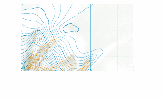
A closed depression formation forming a closed loop and representing an area of lower ground of less than the vertical interval.

See also: contour
Class attributes
| Attribute | Value |
|---|---|
| Object class | depform_edge |
| Entity class | BASIN |
| Additional entity class | Not applicable |
| Object inheritance | graphic_line |
| Entity source | US Standard Entity |
| Map series | Ant50 |
| LSLIFF object class | 501 |
Object attributes
This object class does not have attributes.
Change log
| Feature version | Revised | Description |
|---|---|---|
| 3 | 2012-08-28 | Updated map image and aerial view; added representation specification and example feature photographs |
| 2 | 2001-11-23 | Unspecified update |
| 1 | 1999-03-01 | intial status |