NZ Topo - object class descriptive_text
This page describe the descriptive_text object class used to represent objects in the NZTopo topographic database.
Description
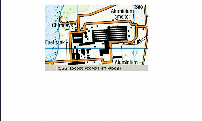
Descriptive text; object used to hold text.
Topo50 description
Descriptive text is used to aid map and data users by displaying and holding useful information in descriptive form.
Topo250 description
Only those significant by their size or location are held in the Topo250 data and shown on the Topo250 printed maps; these are a generalised subset of those shown on the Topo50 series
Ant50 description
Descriptive text is used to aid map and data users by displaying and holding useful information in descriptive form.
See also: geographic_name
Class attributes
| Attribute | Value |
|---|---|
| Object class | descriptive_text |
| Entity class | TEXT |
| Additional entity class | Not applicable |
| Object inheritance | simple_point |
| Entity source | Proposed NZ entity |
| Map series | Topo50 Topo250 Ant50 |
| LSLIFF object class | 703 |
Object attributes
| Attribute | LSLIFF code Shapefile field Data type |
Attribute description | Attribute values* | |||
|---|---|---|---|---|---|---|
| information_displayed | 1182 info_disp string |
Description of an object not represented by a unique symbol or held as a specific feature |
|
|||
| name_macronated | 1140 macronated boolean |
Indicates whether the entry in the name_ascii field contains a macronated vowel. Where the value is "Y" go to http://www.linz.govt.nz/regulatory/place-names/find-place-name/find-m%C4%81ori-place-names-dual-names-and-alternative-names for a list of places or feature names within New Zealand that are gazetted and include macrons |
|
|||
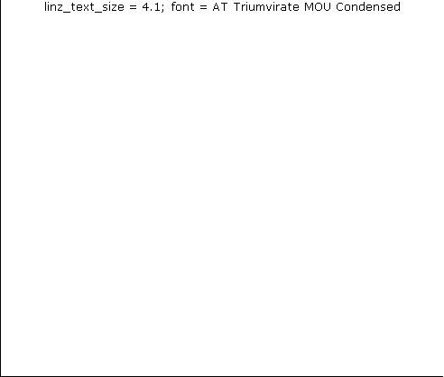
| linz_text_size | 2006 size real |
Value governing text size on LINZ printed map. |
|
|||
| name_ascii | 9000 name_ascii string |
Text data from July 2012 will be in UTF-8 format. If your system is not UTF-8 compliant, you will need to use this attribute, which has had any macronated vowels removed. | ||||
| UFID | 1000 t50_fid integer |
A unique identifier for use on Topo50 data in the LINZ Data Service. This is not a universal ID. The intention is to manage these ID’s as persistent, however this is not guaranteed and there will be instances where what appears to be a minor change to a feature may result in a new ID being assigned. |
|
* See explanation of attribute values for more information about how attribute values are represented.
Change log
| Feature version | Revised | Description |
|---|---|---|
| 11 | 2012-08-28 | Updated map image and aerial view; added representation specification and example feature photographs |
| 10 | 2012-08-28 | Added scale-specific definitions |
| 9 | 2012-08-16 | Name attribute in UTF-8 format; added name_ascii attribute |
| 8 | 2010-03-01 | object class change, removed a number of attributes, and added name_macronated attribute |
| 7 | 2003-06-30 | new attribute |
| 6 | 2002-09-18 | attribute description |
| 5 | 2002-06-18 | attribute description |
| 4 | 2002-04-23 | attribute description |
| 3 | 2001-11-23 | Unspecified update |
| 2 | 2001-09-05 | comments and object attributes |
| 1 | 1999-03-01 | intial status |