NZ Topo - object class geographic_name
This page describe the geographic_name object class used to represent objects in the NZTopo topographic database.
Description
Geographic name holds the proper noun of certain objects within the Topo databases. Geographic_name does not apply to roads, railway lines, or descriptive text - eg 'Brunner Mine' would be a Geographic_name but 'mine disused' is held in the descriptive_text feature
Topo50 description
The geographic name feature layer comprises names that are gazetted by the NZ Geographic Board, and also names from other sources. Most of the gazetted names are held in the data and shown on the printed maps, but ocassionally the limitations of scale preclude this. For authorativie information regarding gazetted geographic names see http://www.linz.govt.nz/placenames/index.aspx. Functions within the LINZ database allow the text to be curved, spaced and placed as it is seen on the map. Be aware that, of the 57,000 names in the database, an estimated 70% have coordinates that are coincident with the real-world feature in the topographic database that it names. Of the features where there are no real-world equivalents (such as bay, point and hill range names), most coordinates remain unaltered from the original capture in the 1980s. At that time demand and resources were such that the quickest method was chosen - to capture the feature at the left lower corner of the text as printed on the 1:50,000 topographic map. Overtime, the remaining 30% of geographic names will be repositioned.
Topo250 description
A generalised subset of those shown on the Topo50 series

See also: descriptive_text
Class attributes
| Attribute | Value |
|---|---|
| Object class | geographic_name |
| Entity class | TEXT |
| Additional entity class | Not applicable |
| Object inheritance | simple_point |
| Entity source | Proposed NZ entity |
| Map series | Topo50 Topo250 Ant50 Topo500 |
| LSLIFF object class | 701 |
Object attributes
| Attribute | LSLIFF code Shapefile field Data type |
Attribute description | Attribute values* | ||
|---|---|---|---|---|---|
| name | 1001 name string |
This field must be populated. Text data from July 2012 will be in UTF-8 format. If your system is not UTF-8 compliant, you will need to use the name_ascii attribute, which has had any macronated vowels removed. UTF-8 stands for Unicode Transformation Format-8. It is an octet (8-bit) lossless encoding of Unicode characters. UTF-8 encodes each Unicode character as a variable number of 1 to 4 octets, where the number of octets depends on the integer value assigned to the Unicode character. It is an efficient encoding of Unicode documents that use mostly US-ASCII characters because it represents each character in the range U+0000 through U+007F as a single octet. UTF-8 is the default encoding for XML. |
|
||
| name_macronated | 1140 macronated boolean |
Indicates whether the entry in the name_ascii field contains a macronated vowel. Where the value is "Y" go to http://www.linz.govt.nz/regulatory/place-names/find-place-name/find-m%C4%81ori-place-names-dual-names-and-alternative-names for a list of places or feature names within New Zealand that are gazetted and include macrons |
|
||
| point_description_code | 1056 desc_code string |
The named object category. | See below | ||
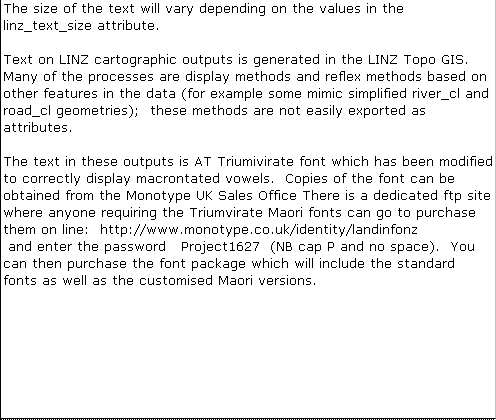
| linz_text_size | 2006 size real |
Value governing text size on LINZ printed map. |
|
||
| name_ascii | 9000 name_ascii string |
Text data from July 2012 will be in UTF-8 format. If your system is not UTF-8 compliant, you will need to use this attribute, which has had any macronated vowels removed. | |||
| UFID | 1000 t50_fid integer |
A unique identifier for use on Topo50 data in the LINZ Data Service. This is not a universal ID. The intention is to manage these ID’s as persistent, however this is not guaranteed and there will be instances where what appears to be a minor change to a feature may result in a new ID being assigned. |
|
* See explanation of attribute values for more information about how attribute values are represented.
point_description_code attributes values
| Value | Description |
|---|---|
| AIR | AIRPORT: Landing ground for aeroplanes |
| BAY | BAY/INLET: A salient of water into the land |
| BCH | BEACH: Sand or gravel shore of a body of water |
| BDGE | BRIDGE: Structure spanning an obstacle |
| BLDG | BUILDING: Man made structure for a specific use |
| BNK | BANK: Underwater eminence which may dry at L.W. |
| BSN | MOUNTAIN BASIN: Bowl shaped depression in land |
| CAVE | CAVE: Subterranean chamber |
| CEM | CEMETERY: Place for burying the dead |
| CGND | CAMPING GROUND: Area used for temporary shelter |
| CLIF | CLIFF: Steep rock face |
| CRTR | CRATER: Depression caused by volcanic activity |
| DAM | DAM: Barrier constructed across a water course |
| ESTY | ESTUARY: Tidal mouth of a river |
| FALL | WATERFALL: Sudden steepening in river gradient |
| FARM | FARM: Area been developed for farming |
| FLAT | FLAT: Relatively level area of land |
| FORD | FORD: Shallow unbridged river crossing |
| FRST | FOREST: Dense growth of trees |
| GEO | GEOTHERMAL AREA: Area of geothermal activity |
| GLCR | GLACIER: Accumulation of slowly moving ice |
| GLKS | GOLF LINKS: Area set out for golf |
| GORG | GORGE/VALLEY: Linear depression in land surface |
| HILL | HILL: A natural elevation of the Earth's surface |
| HIST | HISTORIC: Area/structure of historic importance |
| HOSP | HOSPITAL: Institution for treatment of the sick |
| HSTD | HSTD: Homestead |
| HUT | HUT: Simple rural building for shelter |
| ISLD | ISLAND: Body of land surrounded by water |
| ISTH | ISTHMUS: Neck of land joining two larger areas |
| LAKE | LAKE: Body of inland water |
| LOC | LOCALITY: Defined area of low or nil population |
| LTH | LIGHTHOUSE: Lighted structure for navigation |
| MCUL | MISCELLANEOUS CULTURAL FEATURE: Miscellaneous man-made named place or area |
| METR | METR: Metropolis: Major city |
| MINE | MINE: Excavation for the extraction of minerals |
| MNAT | MISCELLANEOUS NATURAL FEATURE: Miscellaneous naturally occurring named feature or area |
| MPLA | MISCELLANEOUS PLACE:Misc named place or area |
| MRFM | MARINE ROCK FORMATION |
| NAVB | NAVIGATIONAL BEACON: A navigational aid. |
| NLR | NLR: Native Land Reserve or Block |
| PA | PA: A Maori locality |
| PARK | PARK: Area set aside for recreational use |
| PASS | PASS: Low point in a range of hills |
| PEN | PENINSULA: Land area nearly surrounded by water |
| PNT | POINT: Area protruding into water or floodplain |
| POPL | POPULATED PLACE: Populated area less than a town |
| PPLN | PIPELINE: Conduit for carriage of liquids or gas |
| RC | RACECOURSE: Circuit on which races are run |
| RDGE | RIDGE: Elongated elevation of land |
| RDRF | ROAD RELATED FEATURE:Named road object |
| RLYF | RAILWAY RELATED FEATURE: Named railway object |
| RNGE | RANGE: Aligned and connected series of hills |
| ROCK | ROCK: Isolated rocky outcrop |
| RSTN | RAILWAY STATION: Stopping place for trains |
| SBRB | SUBURB: Component part of a town |
| SCH | SCHOOL: Place of instruction |
| SEA | SEA: Ocean or large body of saltwater |
| SKI | SKI: Area for skiing activities |
| SLIP | SLIP: Area of unstable hillside |
| SPR | SPRING: Natural issue of water |
| STRA | STRAIT: Narrow stretch of water |
| STRM | STREAM: Natural watercourse |
| SWMP | SWAMP: Permanently waterlogged area |
| TOWN | TOWN: Town or city forming nucleus of region |
| TRCK | TRACK: Foot path |
| TREE | TREE: Tree with historical significance |
| TRIG | TRIG: Geodetic Station |
| TUNL | TUNNEL: Man made subterranean passage |
| TWAY | TRAMWAY: Narrow gauge bush railway |
| UNIV | UNIVERSITY: Institution of higher learning |
| USAT | URBAN SATELLITE: S/c community adjacent to city |
| WELL | WELL: Hole bored for the extraction of liquid or gas |
| WHF | WHARF: Structure for the berthing of vessels |
| WILD | WILDERNESS AREA: Area preserved in natural state |
| WRCK | WRECK: Wrecked,sunken or stranded vessel |
| WWAY | WATER WAY: Man made water course |
Change log
| Feature version | Revised | Description |
|---|---|---|
| 11 | 2013-06-07 | More information added to Topo50 Description |
| 10 | 2012-08-28 | Updated map image and aerial view; added representation specification and example feature photographs |
| 9 | 2012-08-28 | Added scale-specific definitions |
| 8 | 2012-08-16 | Name attribute in UTF-8 format; added name_ascii attribute |
| 7 | 2010-07-06 | changed point_name attribute to name |
| 6 | 2010-03-01 | object class change, removed a number of attributes, changed attribute description, added name_macronated attribute |
| 5 | 2003-06-30 | new and removed attributes |
| 4 | 2002-09-18 | attribute description |
| 3 | 2002-06-18 | attribute description |
| 2 | 2001-11-23 | unspecified update |
| 1 | 2001-09-05 | initial status |