NZ Topo - object class powerline_cl
This page describe the powerline_cl object class used to represent objects in the NZTopo topographic database.
Description
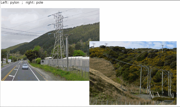
A cable or cables supported by poles or towers for the transmission of electricity
Topo50 description
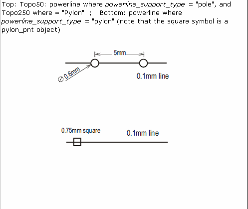
Not all powerlines are held in the data or shown on the printed maps. Eg. where a powerline (on poles) runs closely parallel to a road, it may not the held in the data; and where two powerlines are very close, only one may be held in the data in the data or shown on the printed map. Short sections of powerline are not generally held in the data or shown on the printed maps. Power lines are classified according to the type of structure supporting the line, rather than by the voltage carried. NOTE that the circles on the powerline-on-poles symbol do not represent the positions of the supports.
Topo250 description
Only those significant by their size or location are held in the Topo250 data and shown on the Topo250 printed maps; these are a generalised subset of the powerline on pylons feature shown on the Topo50 series

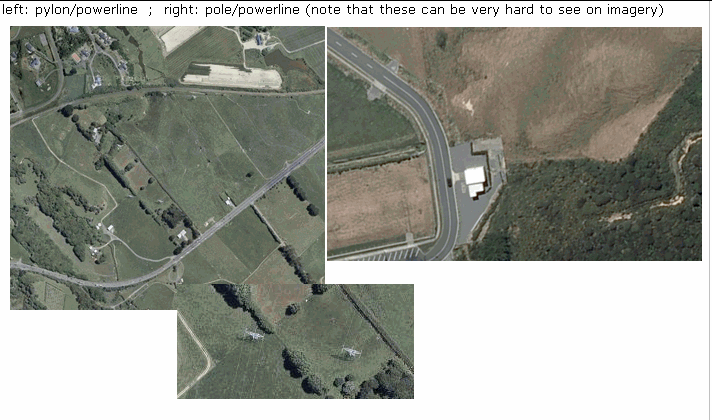
Important information: Not all aerial wires, cableways and obstructions that could be hazardous to aircraft are held in the data or shown on the printed maps
See also: pylon_pnt
Class attributes
| Attribute | Value |
|---|---|
| Object class | powerline_cl |
| Entity class | TRANSMISSION LINE |
| Additional entity class | Not applicable |
| Object inheritance | simple_line |
| Entity source | US Standard Entity |
| Map series | Topo50 Topo250 |
| LSLIFF object class | 96 |
Object attributes
| Attribute | LSLIFF code Shapefile field Data type |
Attribute description | Attribute values* | ||
|---|---|---|---|---|---|
| powerline_support_type | 1067 support_ty string |
|
|||
| UFID | 1000 t50_fid integer |
A unique identifier for use on Topo50 data in the LINZ Data Service. This is not a universal ID. The intention is to manage these ID’s as persistent, however this is not guaranteed and there will be instances where what appears to be a minor change to a feature may result in a new ID being assigned. |
|
* See explanation of attribute values for more information about how attribute values are represented.
Change log
| Feature version | Revised | Description |
|---|---|---|
| 6 | 2012-08-28 | Updated map image and aerial view; added representation specification and example feature photographs |
| 5 | 2012-08-28 | Added scale-specific definitions |
| 4 | 2010-03-01 | Updated comments section |
| 3 | 2001-11-23 | Unspecified update |
| 2 | 2001-08-21 | comments |
| 1 | 1999-03-01 | intial status |