NZ Topo - object class soakhole_pnt
This page describe the soakhole_pnt object class used to represent objects in the NZTopo topographic database.
Description
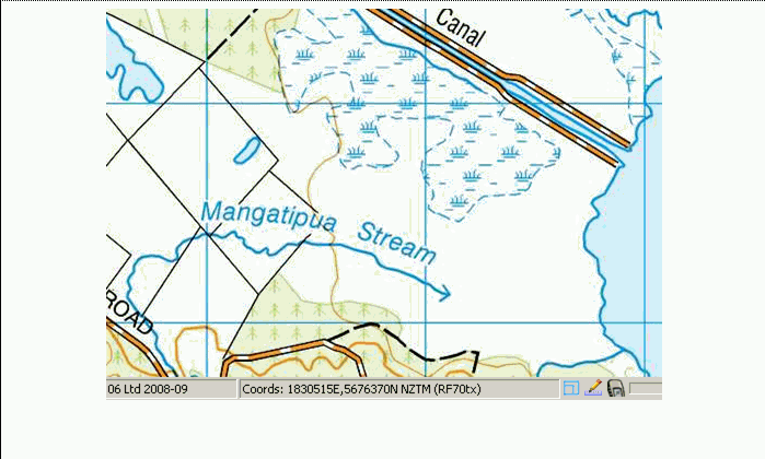
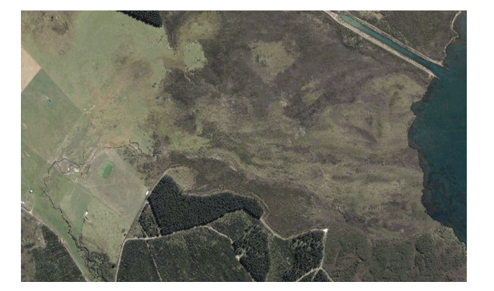
The point at which a river or stream percolates into or through the soil.
Topo50 description
Only those significant either by their size or location are held in the data and shown on the printed maps.
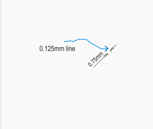
See also: river_cl
Class attributes
| Attribute | Value |
|---|---|
| Object class | soakhole_pnt |
| Entity class | SOAKHOLE |
| Additional entity class | Not applicable |
| Object inheritance | graphic_point |
| Entity source | Proposed NZ Std Entity |
| Map series | Topo50 |
| LSLIFF object class | 158 |
Object attributes
| Attribute | LSLIFF code Shapefile field Data type |
Attribute description | Attribute values* | |
|---|---|---|---|---|
| orientation | 1115 orientatn string |
The orientation or angle of the feature as it is shown on the map. This is measured in radians starting from due east, in a counter- clockwise direction for positive numbers or clockwise for negative numbers. |
|
* See explanation of attribute values for more information about how attribute values are represented.
Change log
| Feature version | Revised | Description |
|---|---|---|
| 7 | 2020-04-08 | added orientation attribute |
| 6 | 2012-08-28 | Updated map image and aerial view; added representation specification and example feature photographs |
| 5 | 2012-08-28 | Added scale-specific definitions |
| 4 | 2010-03-01 | removed orientation attribute |
| 3 | 2002-06-18 | new attribute |
| 2 | 2001-11-23 | Unspecified update |
| 1 | 1999-03-01 | intial status |