NZ Topo - object class river_cl
This page describe the river_cl object class used to represent objects in the NZTopo topographic database.
Description
A natural, flowing body of water emptying into an ocean, lake or other body of water and usually fed along it's course by converging tributaries.
Topo50 description
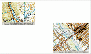
A river_cl depicts a water course where water can or does flow. Only those rivers significant by their size and location are held in the data and shown on the printed maps. River_cl is used when the river is too small to be captured at 1:50,000 as an area feature. In the instance of highly braided rivers, only a subset of the braids will be shown. Note that the NZ Geographic Board is working on a project to define the spatial extents for the river names held in the Gazetteer. When this work is complete, the name field will be populated based on these extents.
Topo250 description
Only those significant by their size or location are held in the Topo250 data and shown on the Topo250 printed maps; these are a generalised subset of those shown on the Topo50 series
See also: floodgate_pnt ford_pnt rapid_cl river_poly soakhole_pnt waterfall_pnt weir_cl
Class attributes
| Attribute | Value |
|---|---|
| Object class | river_cl |
| Entity class | WATERCOURSE |
| Additional entity class | Not applicable |
| Object inheritance | simple_line |
| Entity source | US Standard Entity |
| Map series | Topo250 Topo50 Topo500 |
| LSLIFF object class | 122 |
Object attributes
This object class does not have attributes.
Change log
| Feature version | Revised | Description |
|---|---|---|
| 8 | 2013-04-04 | added information about name attribute |
| 7 | 2012-08-28 | Updated map image and aerial view; added representation specification and example feature photographs |
| 6 | 2012-08-28 | Added scale-specific definitions |
| 5 | 2010-03-01 | removed attribute river_definition |
| 4 | 2008-04-10 | Removed reference to seed and void objects |
| 3 | 2001-11-23 | Unspecified update |
| 2 | 2001-07-01 | comments |
| 1 | 1999-03-01 | intial status |


