NZ Topo - object class wharf_edge
This page describe the wharf_edge object class used to represent objects in the NZTopo topographic database.
Description
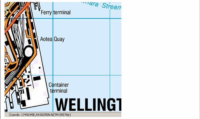
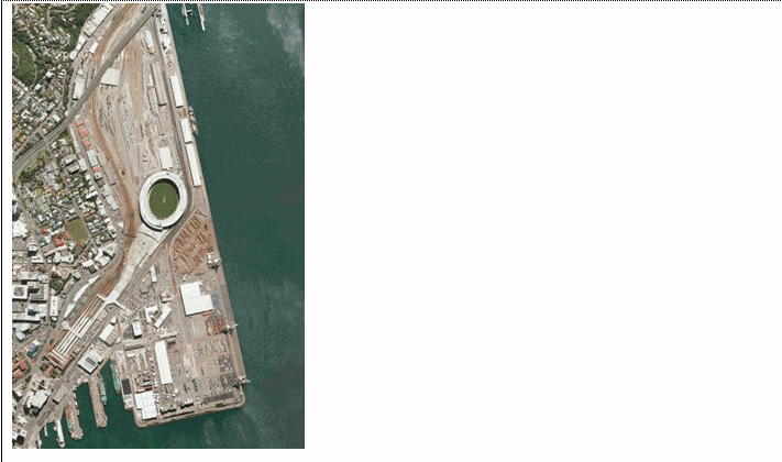
Any structure on a waterfront, designed to make it possible for vessels to lie alongside and take or unload cargo, passengers etc.
Topo50 description
Only those significant either by their size or location are held in the data and shown on the printed maps. Narrower features are captured as a centreline
Topo250 description
Only those significant by their size or location are held in the Topo250 data and shown on the Topo250 printed maps; these are a generalised subset of those shown on the Topo50 series

See also: coastline
Class attributes
| Attribute | Value |
|---|---|
| Object class | wharf_edge |
| Entity class | WHARF |
| Additional entity class | Not applicable |
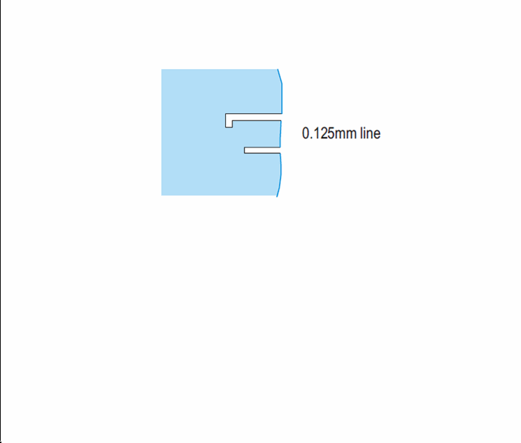
| Object inheritance | simple_line |
| Entity source | Proposed change to US Entity |
| Map series | Topo50 Topo250 Ant50 |
| LSLIFF object class | 188 |
Object attributes
This object class does not have attributes.
Change log
| Feature version | Revised | Description |
|---|---|---|
| 4 | 2012-08-28 | Updated map image and aerial view; added representation specification and example feature photographs |
| 3 | 2012-08-28 | Added scale-specific definitions |
| 2 | 2001-11-23 | Unspecified update |
| 1 | 1999-03-01 | intial status |