NZ Topo - object class floodgate_pnt
This page describe the floodgate_pnt object class used to represent objects in the NZTopo topographic database.
Description
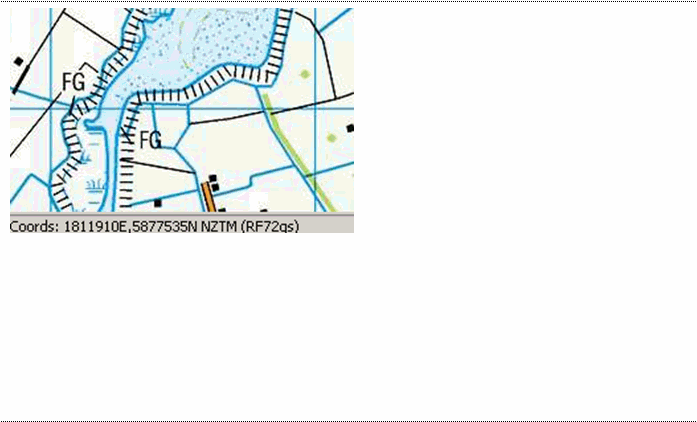
Gate opened and closed to admit or exclude water.
Topo50 description
Floodgates have become a legacy feature. This means that they will remain in the data until a sheet undergoes revision. During this process, the floodgates will be deleted for that sheet,

See also: river_cl river_poly
Class attributes
| Attribute | Value |
|---|---|
| Object class | floodgate_pnt |
| Entity class | GATE |
| Additional entity class | Not applicable |
| Object inheritance | graphic_point |
| Entity source | US Standard Entity |
| Map series | Topo50 |
| LSLIFF object class | 41 |
Object attributes
| Attribute | LSLIFF code Shapefile field Data type | Attribute description | Attribute values* | |
|---|---|---|---|---|
| orientation | 1115 orientatn string | The orientation or angle of the feature as it is shown on the map. This is measured in radians starting from due east, in a counter- clockwise direction for positive numbers or clockwise for negative numbers. |
|
* See explanation of attribute values for more information about how attribute values are represented.
Change log
| Feature version | Revised | Description |
|---|---|---|
| 8 | 2012-08-28 | Updated map image and aerial view; added representation specification and example feature photographs |
| 7 | 2012-08-28 | Added scale-specific definitions |
| 6 | 2012-08-27 | Updated Topo50 description |
| 5 | 2010-03-01 | object class change and removed attribute river_definition |
| 4 | 2002-06-18 | new attribute |
| 3 | 2001-11-23 | Unspecified update |
| 2 | 1999-10-01 | new attribute |
| 1 | 1999-03-01 | initial status |